
Over the past year, SCA has blocked ditches across a 150-hectare wetland area in Lycksele Municipality. In total, around 15 km of century-old ditches have been restored with funding through LONA. “We can already see positive effects of the re-wetting",says Ulf Hallin, Nature Conservation Specialist at SCA.
SCA land host for major road project
- News
- Forest
- För skogsägare
The EU project Northern Traffic Lights aims to develop digital solutions that can monitor and predict the trafficability and maintenance needs of private gravel roads. SCA is participating as a land host in a project part led by Skogforsk. “We now have two advanced weather stations on our road network along the Norrland coast”, says Daniel Yring, Business developer at SCA Skog.

Well-maintained forest roads that can be used for heavy traffic are crucial for timber transport in the forestry industry. However, today many roads cannot be used during spring thaw and rainy periods, and with climate change the period when roads are impassable is expected to increase, while road conditions are likely to deteriorate faster.
“SCA has approximately 26,000 kilometers of forest roads on its land holdings. But there is no system that helps us keep track of road status. Only when road damage has already occurred do we, in the best case, find out about it somehow, for example from local residents, contractors, authorities or other stakeholders. That is why this project is both urgent and important, and it was given for us to take part”, says Daniel.
Digital platform
The Northern Traffic Lights project runs from April 2025 to March 2028. The work is coordinated from Finland and involves a range of universities and organizations in Sweden and Finland. In Sweden, participants include Skogforsk, SLU and Luleå University of Technology.
The aim is to develop digital solutions, a kind of online platform, that can monitor and predict both the trafficable private gravel roads and their maintenance needs. In this way, one can ensure more resilient supply for forestry and natural resources to support transition to a green and sustainable rural economy in a changing climate.
“For SCA and other in the forestry industry, it is essential to know whether a specific forest road is passable at a given time so that we can move forest machinery and transport timber to the right industry and sawmill at the right time. The information is also beneficial for private landowners and other green industries such as agriculture, as well as rescue services and others working with roads and transport”, says Daniel.
Advanced weather stations

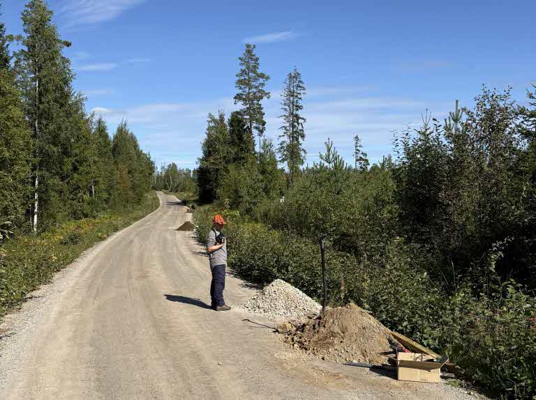
Cable for a sensor connected to the measuring equipment that records temperature, water saturation and frost directly adjacent to the weather stations. Each station has three sensors installed at three different depths in the road surface: 20, 50 and 80 cm.
The project consists of five work packages: information systems for private gravel roads, extension of road weather stations, dynamic trafficability modeling, on-line trafficability platform Northern Traffic Lights and networking and dissemination. Several of the work packages are interconnected.
In one project, led by Skogforsk, SCA is acting as the land host. Skogforsk has installed three highly advanced weather stations along the Norrland coast, and two of the stations are located on SCA’s road network.
“One station is in Galtström south of Sundsvall and the other in Överkalix, says Daniel. There are also weather stations in Finland.”
Over a period of a couple of years, the weather stations will collect information on, among other things, precipitation, temperature, solar radiation and wind.
“We have also installed measuring equipment at different depths in the road surface to measure temperature, water saturation and frost directly adjacent to the weather stations”, explains Daniel.
While the weather stations collect weather data, field staff from Skogforsk will measure and record the roads’ elasticity every month using falling weight deflectometers. Falling weight measurements are used to measure and assess road bearing capacity, that is, how much heavy traffic a road can withstand before it is damaged or deformed.
Predict how a road respond
“The idea behind the project is that all the collected data, combined with data from the falling weight measurements and data from the Swedish Meteorological and Hydrological Institute (SMHI), will make it possible to predict with greater accuracy how a road will respond to a specific weather situation, and how road-related problems can be prevented”, Daniel explains.
If the project leads to a system and new working methods that enable real-time information about road accessibility, it could improve transport economics, make road maintenance more cost-effective and also reduce the use of gravel material.
“Getting a system that helps us predict how roads behave would mean a lot for us. It would also help us assess how many resources we need to allocate to, for example, maintenance. This is especially important as climate change, with more precipitation and shorter frost periods, can contribute to increased maintenance costs.”
Photo: Daniel Yring
Latest news on this topic

The world’s first electric timber truck has completed its run
The world’s first electric timber truck has completed its time on the road in SCA’s service. After four years and around 130 000 kilometers, the world’s first electric timber truck has now completed its time on the road. During the summer, SCA and Grundbergs Åkeri, which operated the truck, handed it back to Scania. The electric drivetrain has resulted in 220,000 kilograms lower carbon dioxide emissions.

SCA’s pine of the future
SCA is preparing the next generation of pine seedlings – with up to 30 percent greater carbon sequestration capacity and increased tolerance to warmer weather.